• Skip to primary navigation
  • Skip to main content
  • Skip to primary sidebar
  • Skip to footer

Hansaviertel Berlin

Hansaviertel Berlin

  • English
  • Deutsch
  • Interbau 1957 live
    • Interactive map
    • Guided Tours
  • Interbau 1957
    • The History of Interbau 1957
    • Architects
    • Buildings
    • the city of tomorrow
    • Landscape architecture
    • Art
    • Unité d’habitation and the Congress Hall
    • Impressions
  • History
    • History until 1933
    • The years 1933–1945
    • November 22nd, 1943
    • The years 1945–1953
    • Jewish Neighbors
    • Prominent residents
    • Views of the old Hansaviertel
  • Actuality
    • News
    • Marketplace
    • Hansaviertel for children and young people
    • Sources of the Hansaviertel
  • Bürgerverein
    • About us
    • Activities and Working Groups
    • Partner
    • Charter
    • Become a member
    • Shop
  • UNESCO
    • On the way to becoming a World Heritage Site
    • Coalition Agreement
    • Submission
  • Downloads
  • Interbau 1957 live
    • Interaktive Map
    • Guided Tours
  • Interbau 1957
    • The History of Interbau 1957
    • Architects
    • Buildings
    • Impressions
  • History
    • History until 1933
    • The years 1933–1945
    • November 22nd, 1943
    • The years 1945–1953
    • Jewish Neighbors
    • Prominent residents
    • Views of the old Hansaviertel
  • Actuality
  • Bürgerverein
    • About us
    • Activities and Working Groups
    • Partner
    • Charter
  • UNESCO
    • On the way to becoming a World Heritage Site
    • Coalition Agreement
    • Submission
    • Publication of the proposal
Start | History | History until 1933

History until 1933

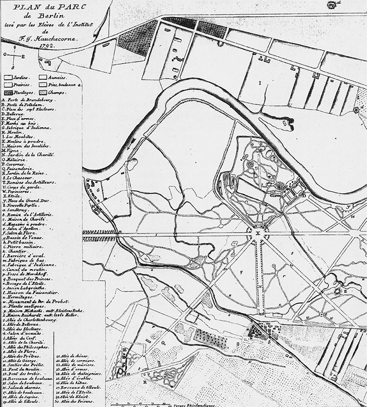
From the “Schöneberger Wiesen” to grand residential neighborhood

By choosing the Hansaviertel as the show ground for the Interbau building exhibition, the West Berlin Senate chose an area that had developed architecturally in a way that was typical for Berlin. At the end of the 18th century the “Schöneberger Wiesen” was still an undeveloped floodplain, but the quarter quickly grew into an urban residential area in the 19th century. As a result of industrialization and urbanization, Berlin’s population grew rapidly: in 1824 the city still had 220,000 inhabitants, by 1875 almost one million and by the end of the 19th century 2.7 million. The resulting housing shortage was countered by the construction of apartment buildings, initially consisting of a front building with side wings plus a rear building, and divided into apartments, as recommended in the planning design book by the master builder Gustav Assmann in 1862. (1) Assmann did not foresee the densification of the buildings that would result from the housing shortage and land speculation. For workers and low-income earners, rear buildings with up to seven courtyards were strung together. Dark, small and poorly ventilated apartments were built, which were extremely overcrowded. These so-called tenement houses became the enemy of architects and urban planners from the very beginning, especially from the first decade of the 20th century.

Plan of the northwestern Tiergarten, by F.G. Hauchecorne, 1792 Der Tiergarten mit Bellevue, Tiergartenmühle und Kattunfabrik (nach dem Plan von F. G. Hauchecorne von 1792)

Landesarchiv Berlin

Plan of the Schöneberger Wiesen in northwest Tiergarten, development plan of the surroundings of Berlin, Department V Charlottenburg, 1862 Bebauungsplan der Umgebungen Berlins, Abteilung V. Charlottenburg. Genehmigt durch Allerhöchste Cabinetts Ordre vom 26. July 1862
Landesarchiv Berlin
Plan 1879 Bebauungsplan der Umgebung Berlins, Abteilung V. Charlottenburg. Genehmigt duch Allerhöchste Cabinets Ordre vom 26. July 1862, fortgeschrieben um die in der Ordre vom 21.03.1874 festgelegten Straßen und mit den in der Ordre vom 30.April.1879 festgelegten Straßennamen
Landesarchiv Berlin
Plan 1908–10 Jul. Straube Übersichtsplan Berlin, berichtigt 1908-10, aus: Denkmaltopographie Bundesrepublik Deutschland, Denkmale in Berlin, Bezirk Mitte Ortsteile Moabit, Hansaviertel und Tiergarten, Petersberg 2005
Landesdenkmalamt Berlin

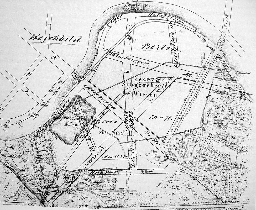
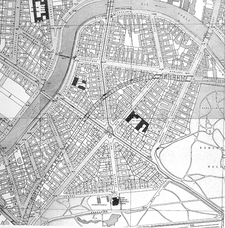
Parallel to the densely populated working-class districts, forms of housing also developed for the better-off sections of the population. Spurred by the rising prosperity of large parts of the middle classes, new villa colonies grew on the outskirts of large cities. In Grunewald and Lichterfelde, and from the 1890s in Berlin-Dahlem, areas with detached, generously proportioned residential buildings emerged. On the other hand, inner-city residential areas were also developed for wealthy citizens. The Hansaviertel was also gripped by this bourgeois building boom. After the foundation of the Reich in 1874, the Berlin-Hamburger Immobilien-Gesellschaft began to develop the area and drew up a development plan confirmed by a Royal Order of 21 March 1874. This order is regarded as the founding document of the Hansaviertel. (2) This plan already allows for the intersection of three main streets in a star-shaped square, which was named “Hansaplatz” in 1879 in memory of the Berlin-Hamburger Immobilien-Gesellschaft and Berlin’s Hanseatic tradition. In the following years, the entire residential district was recorded as “Hansaplatz-Bezirk Nr. 211” (3) and eventually as “Hansaviertel”.

The Hansaviertel before 1943 with the central square Hansaplatz  © Landesarchiv Berlin
The Hansaviertel between Spreebogen and Bellevue (around 1920) © Landesarchiv Berlin

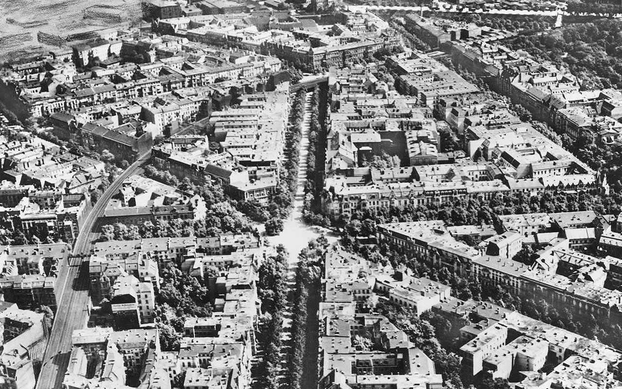
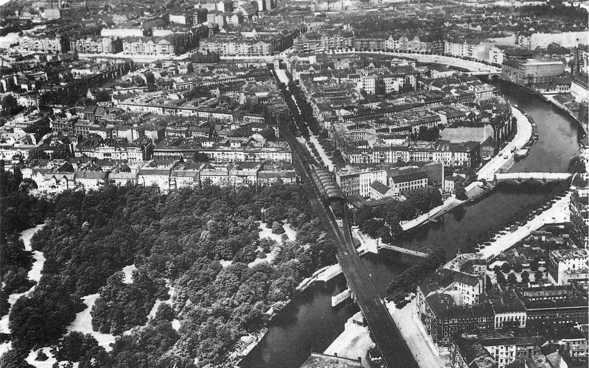
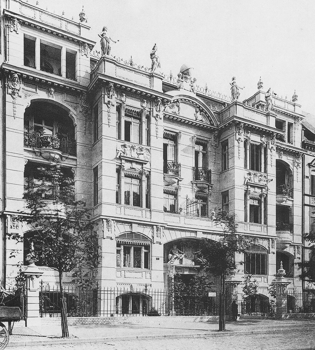
The city railway built between 1877 and 1882 connected the quarter to the city center and divided it into a north-eastern and a south-western area. Many prominent architects in Berlin – among them the builder of the Wertheim department store (1896–1906) Alfred Messel and the court architect Ernst von Ihne, who had also built the Bode Museum (1897–1904) and the State Library (1908–1914) (4) – built prestigious, adjoining residential buildings with small front gardens along the roadsides on long and narrow parcels of land. They were typically divided by front and rear buildings with inner courtyards. Some shops also moved into the lower ground floor of the residential buildings. The front buildings, which were limited by the Royal Order of 1874 to one ground floor and two upper floors only, were vividly designed with bay windows, turrets, gables and balconies and formed an imposing street scene.

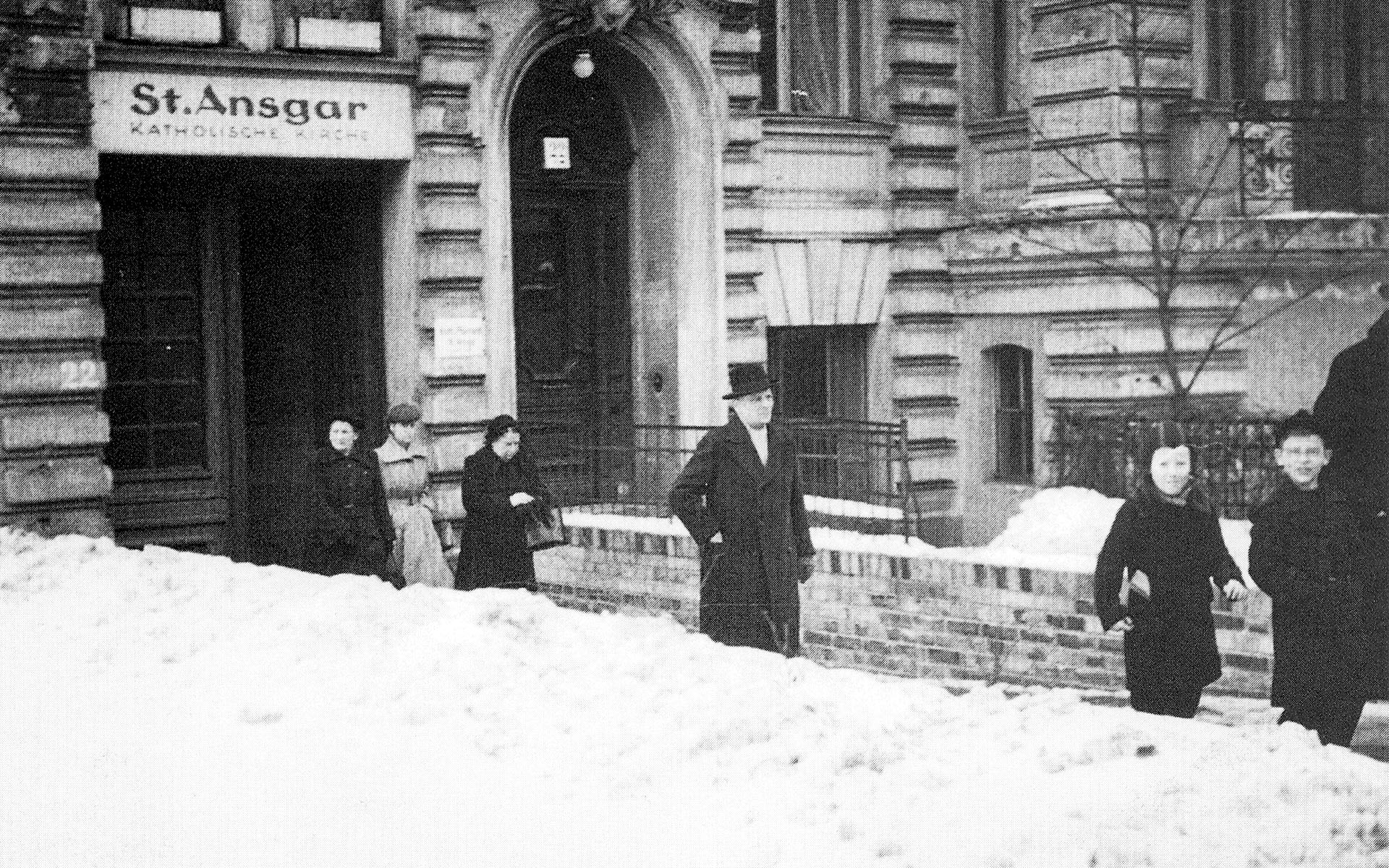
Elaborately composed facades in the historicist and eclectic styles showed a combination of historical stylistic renderings such as columns, cornices and friezes, some of which were also joined together with timber framing. The neo-baroque and neo-renaissance façades were also designed to satisfy the residents’ need for prestige and their sense of standing. The residential development was clearly demarcated from the adjacent Tiergarten, which was only used for leisure activities. The development of the Hansaviertel was largely completed in the 1890s. In 1895 the Kaiser-Friedrich-Gedächtniskirche was consecrated as a votive church for Friedrich III, who died in 1888. In 1926, a carriage house on the property at Altonaer Straße 22 was converted into a chapel for the Catholic community and dedicated to Saint Ansgar. (5)

Residential building Brückenallee 1 (Villa Augusta). Today, the Academy of Arts is located near to where these properties once stood.© Landesarchiv Berlin
Residential building Altonaer Straße 22: behind the residential building was the Court Church St. Ansgar.Archiv Kirche St. Ansgar

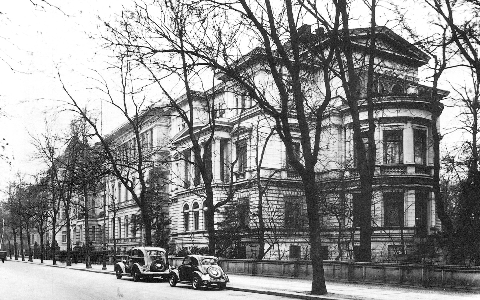
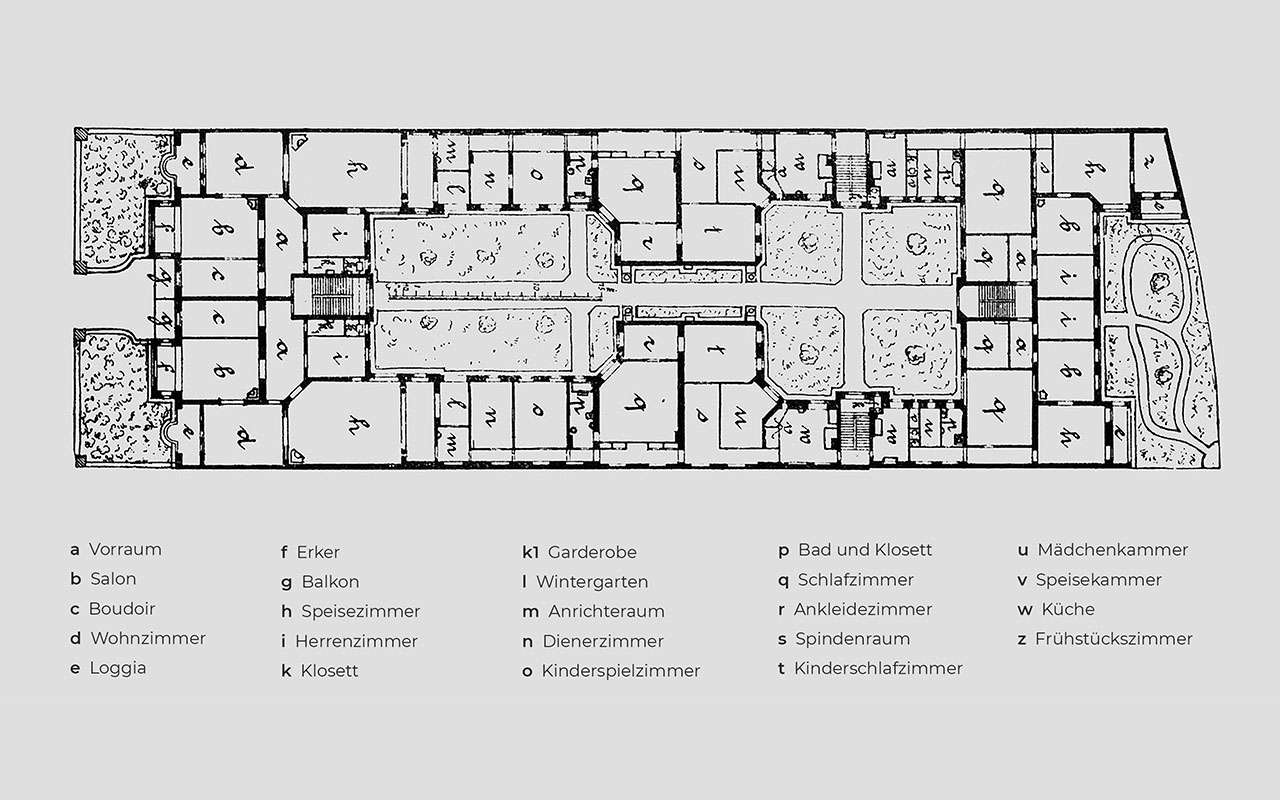
An example of bourgeois living was demonstrated in the residential building at Klopstockstraße 22, where two nine-room apartments were located in the front building, each of which extended via a side wing into the intermediate building and to the second inner courtyard. Accessible from the middle of the front building, the grand boudoir, living room and salon were behind the elaborately designed façade and looked on to the street. The smaller rooms for supplies and personnel, on the other hand, were located at the back of the apartment. Each apartment had a so-called “Berliner Zimmer” (“Berlin Room”), which was relatively large, but had only one window to the inner courtyard and was therefore often stuffy and dark. These rooms were mostly used as passage rooms or dining rooms. In addition, the apartments had the typical long, interior dark hallway. In the back building of the second garden courtyard there were two five-room apartments for those with more modest pretensions. As in the tenements, the further back the apartment was, the less comfortable it was to live in.

Neo-baroque frontage of the residential building Klopstockstraße 22 Front view. Former location between the present houses Bartningallee 7 and 9 Broek/Bakema and Hassenpflug.
Staatliche Museen zu Berlin – Kunstbibliothek
Floor plan Klopstockstraße 22: Nine-room apartment in the front building (left), in the side wings and partly in the intermediate building. Smaller apartments in the back building Staatliche Museen zu Berlin – Kunstbibliothek

Residents in the Hansaviertel

During the imperial era and the Weimar Republic, the Hansaviertel was one of the “residential areas of discerning people”. (6) Among those who settled here were merchants, bankers and other wealthy citizens, as well as civil servants and artists who turned the attics into studios. Among the most famous inhabitants of the old Hansaviertel were the painter Lovis Corinth (1858–1925) and the graphic artist Hermann Struck (1876–1944), the lyric poet Nelly Sachs (1891–1970) and the poet Else Lasker-Schüler (1869–1945), the builder of the Berlin cathedral Julius Raschdorff (1823–1914), the banker K. v.d. Heydt and K. Ländsberg and for a short time Rosa Luxemburg (1870–1919) and her secretary Mathilde Jacob (1873–1943). (7)

See also: Prominent residents

The proportion of Jewish inhabitants was remarkably high. In the twenties it amounted to 8 %, almost double the Jewish proportion of the total population of Berlin. About 10 % of the houses in the Hansaviertel were Jewish property. Two synagogues were built, located on the corner of Lessing/Flensburger Straße and on the bank of the Spree in Siegmunds Hof. Another synagogue within easy reach on Levetzowstraße was frequented by large numbers of Jews from the Hansaviertel district. (8)

See also: Jewish neighbours


Dr. Sandra Wagner-Conzelmann

>  The years 1933–1945

Primary Sidebar

Timeline

Timeline

  • Until 1933
    Development and settlement
    Until the end of the 18th century, the “Schöneberger Wiesen” are still undeveloped floodplains. At the end of the 19th century, the district quickly becomes a sought-after urban residential quarter.
  • 1933–1945
    Under the swastika
    Plans to convert Berlin into a prestigious seat of government and the imperial capital “Germania” also have an impact on the residents of the Hansaviertel. Many Jewish citizens are deported.
  • 1943
    Destruction in World War II
    Several air raids in January and March 1943 and, above all, a major attack in the night of 22 to 23 November 1943 almost completely destroy the Hansaviertel of the imperial age.
  • 1945–1953
    After the war
    Of the 343 houses, 70 remain, many of them badly damaged. About 4000 people still live in the narrowest of spaces and between rubble.
  • 1951
    Stalinallee
    Stalinallee is built before the Hansaviertel and is regarded as a model for metropolitan architecture and urban planning in the GDR. The architect Hermann Henselmann was inspired by the “Socialist Classicism” of the Soviet Union.
  • 1953
    Tendering of the Interbau
    As a reaction to Stalinallee, the Senate announces an ideas competition for the reconstruction of the Hansaviertel and declares it the core area of the International Building Exhibition Interbau.
  • 1957
    Interbau 57
    With the International Building Exhibition, the new Hansaviertel, a modern urban quarter with designs by numerous internationally renowned architects, is created. The individually designed buildings in an open development represent an alternative model to the uniform monumental architecture of Stalinallee in the eastern part of the city.
  • 1980er Jahre
    Hansaviertel before the fall of Communism
    Interest in this residential area wanes in the 80s. Among other things, the homogenous demographic is criticized. In addition, the peripheral location makes the Hansaviertel less attractive after the Wall is built.
  • 2018
    25 years after reunification
    The turning point comes after the fall of the Wall. The quarter moves back into the center. In 1995, it becomes a protected monument and gains popularity. Today, it is a sought-after residential area. Berlin wants to have the Hansaviertel and the former Stalinallee put on the UNESCO World Heritage list.

Southern Hansaviertel before and after its destruction

Footer

This website was created with the kind support
of the LOTTO-Foundation Berlin

LOTTO-Stiftung

Unterstützen Sie uns!

Support us with a donation!
We will share our bank details with you at
info(at)hansaviertel.berlin.
If you give us your address, we will
gladly issue you with a donation receipt.

  • Bibliography
  • Contact
  • Imprint
  • Privacy Policy

Deprecated: Hook genesis_footer_creds_text is deprecated since version 3.1.0! Use genesis_pre_get_option_footer_text instead. This filter is no longer supported. You can now modify your footer text using the Theme Settings. in /kunden/72263_10557/hv18/wp-includes/functions.php on line 5758

Copyright © 2023 · Bürgerverein Hansaviertel e. V.

  • Downloads
  • Interbau 1957 live
    ▼
    • Interaktive Map
    • Guided Tours
  • Interbau 1957
    ▼
    • The History of Interbau 1957
    • Architects
    • Buildings
    • Impressions
  • History
    ▼
    • History until 1933
    • The years 1933–1945
    • November 22nd, 1943
    • The years 1945–1953
    • Jewish Neighbors
    • Prominent residents
    • Views of the old Hansaviertel
  • Actuality
  • Bürgerverein
    ▼
    • About us
    • Activities and Working Groups
    • Partner
    • Charter
  • UNESCO
    ▼
    • On the way to becoming a World Heritage Site
    • Coalition Agreement
    • Submission
    • Publication of the proposal